Introduction & Basic Information
Vegetation plays a key role not only in the reduction of flood risks by increasing the infiltration of rainwater into the ground but also through improving the quality of neighbourhoods by providing a green and healthy environment.
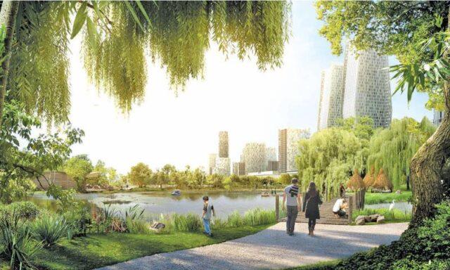
Vegetation substantially reduces the volume and rate of stormwater runoff and helps protect soil from erosion and reduces flash flooding. Increasing vegetation is effective for moderate and heavy rainfall events when combined with other interventions such as a Wadi (a ditch or ditch filled with gravel and sand, which can both retain and infiltrate water) and Blue-Green parks. It is also effective for reducing the risks of permanent flooding, depending on the infiltration and capacity of the soil/ groundwater aquifer. Vegetation can also contribute to the reduction of water pollution and water-borne diseases when properly designed and when choosing the right vegetation. Bishan-Ang Mo Kio Park Singapore is a good example. It is very effective for the recharging of the groundwater aquifers, improving water supply and in some areas, it might reduce the salinity levels of the groundwater. It also lowers the peak discharges downstream and reduces the impact of flooding in the downstream catchment areas.
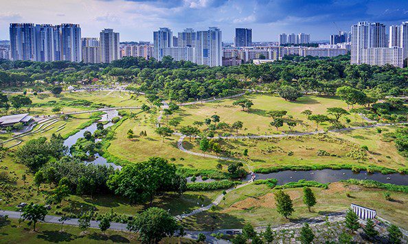
Vegetation, especially trees, can reduce heat stress by providing shade to the surrounding areas and creating a microclimate zone. Inclusive and integral design of interventions can improve the liveability and attractiveness of the neighbourhood; strengthen social cohesion; and develop the economic potential for the local community. Example: Planting fruit bearing trees with a diverse use of the areas and combining with waste awareness etc. It can also strengthen the value of water awareness as a visibility of water by combining interventions with multifunctional place-making designs.
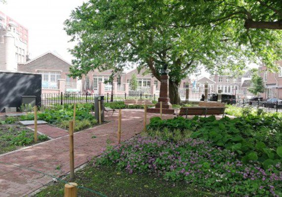
(Photo Source: Amsterdam Rainproof)
Stakeholder engagement
For the interventions, community plays an important role for:
- local knowledge on situation
- participation in implementation
- awareness/ behaviour change
For example, choosing the trees together with the community while co-designing and discussing the reasons and sharing the holistic story or awareness.
The role of the government (example, YCDC) is vital in:
- local knowledge/ current situation
- technical design
- implementation
- mainstreaming
- maintenance / operation.
Content & Technical Design
The location of vegetation should be in the private or communal or public domain, but preferably in communal areas to set an example for private areas, with the scope from drainage level to ward level in combination with a larger catchment. To develop the interventions of increasing vegetation, the information on groundwater aquifer in relation to possible recharge, DTM (topographic information), drainage map, an overview of bottlenecks, land use map, and flood data including the sources of flooding (river/local rainfall/combination), hydraulic data, rainfall data, and frequency are needed alongside the expertise of Hydrology, Civil Engineering, and Landscape Architecture.
Multi-Criteria Analysis
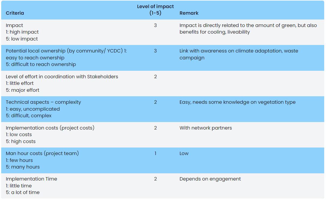
| Criteria | Level of impact (1-5) | Remark |
|---|---|---|
| Impact 1: high impact 5: low impact |
3 | Impact is directly related to the amount of green, but also benefits for cooling, liveability |
| Potential local ownership (by community/ YCDC) 1: easy to reach ownership 5: difficult to reach ownership |
3 | Link with awareness on climate adaptation, waste campaign |
| Level of effort in coordination with Stakeholders 1: little effort 5: major effort |
2 | |
| Technical aspects – complexity 1: easy, uncomplicated 5: difficult, complex |
2 | Easy, needs some knowledge on vegetation type |
| Implementation costs (project costs) 1: low costs 5: high costs |
2 | With network partners |
| Man hour costs (project team) 1: few hours 5: many hours |
1 | Low |
| Implementation Time 1: little time 5: a lot of time |
2 | Depends on engagement |

