Introduction & Basic Information
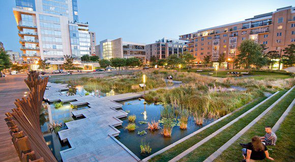
Permeable surfaces allow water to percolate into the soil, reducing the volume of stormwater runoff and recharging the water table. Permeable surfaces can range from porous or pervious pavements to interventions such as a wadi (a ditch or ditch filled with gravel and sand, which can both retain and infiltrate water) and Blue-Green parks. They are built preferably in areas with a sandy soil, to promote infiltration, but can also be used in more clayish/ mixed soils. Depending on infiltration and capacity of the soil/ groundwater aquifer, permeable surfaces can be effective for reducing the risks of both temporary and permanent flood by moderate and heavy rainfall events.
© atelier GROENBLAUW, Amar Sjauw En Wa
Increasing the infiltration is also effective for the recharging of the groundwater aquifers, improving water supply. In some areas it might reduce the salinity levels of the groundwater. It also lowers the peak discharges downstream and reduces the impact of flooding in the downstream catchment areas.
Content and Technical Design
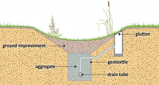
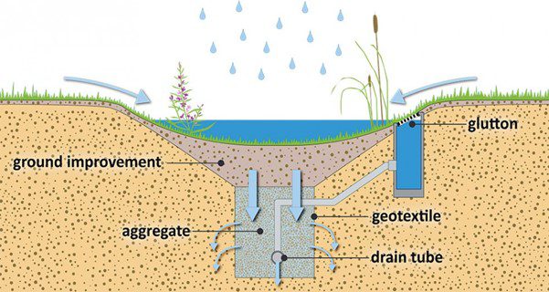
These two cross-sections show the functioning of a wadi – the first one shows the situation in a dry situation, the second one in a wet situation. This design is quite technical; in the middle of the wadi the water can infiltrate through soil which is ‘improved’ to increase infiltration rates, into an confined area (aggregate) from where the water enters the soil. There is also a glutton; a tube that collects rainwater and directly leads it to the confined area, from where it can infiltrate the soil.
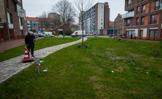
You can also make a less technical intervention, by only making a lowered area where the excess of water can be collected and can slowly infiltrate in the soil, instead of entering the drainage system and leaving the area through surface flow.
Here you can find more information on bioswales: www.urbangreenbluegrids.com/measures/bioswales/ On this website you can also find more information on several interventions to improve climate resilience in cities.
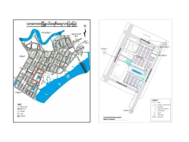
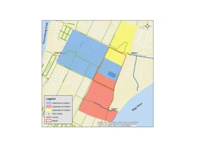
To develop the interventions, the informations on groundwater aquifers in relation with possible recharge, DTM (topographic information), drainage map, overview of bottlenecks, land use map, and flood data including the sources of flooding (river/local rainfall/combination), hydraulic data, rainfall data, and frequency are needed alongside the experticies of Hydrology, Civil Engineering, and Landscape Architecture. In this WIKI more information can be found on a possible design to increase infiltration, in combination with temporarily storing water before it can be drained out of the area.
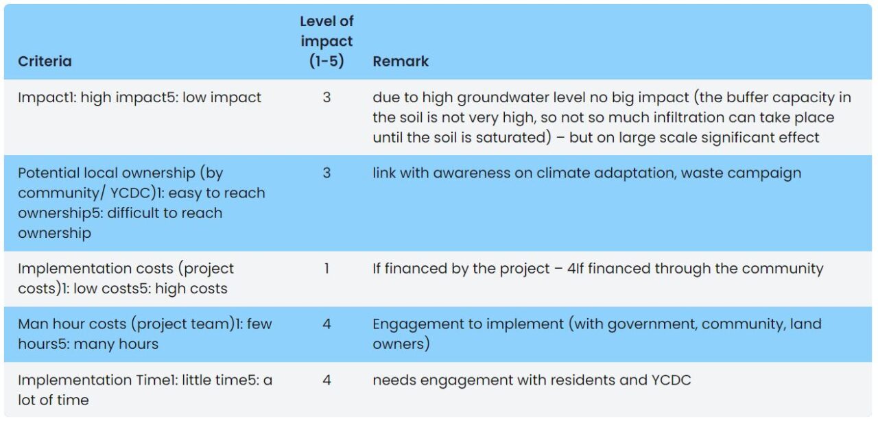
Multi-Criteria Analysis